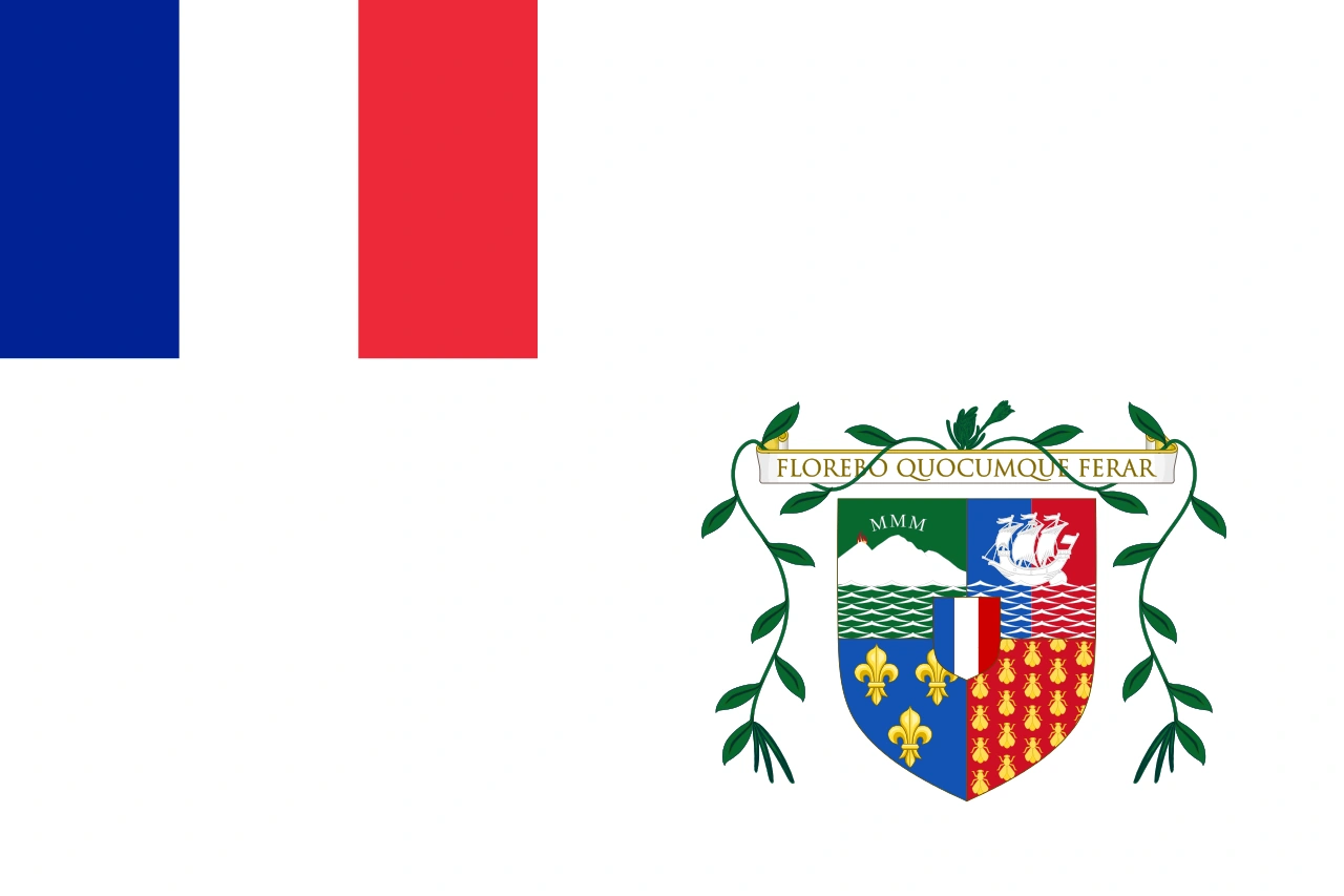
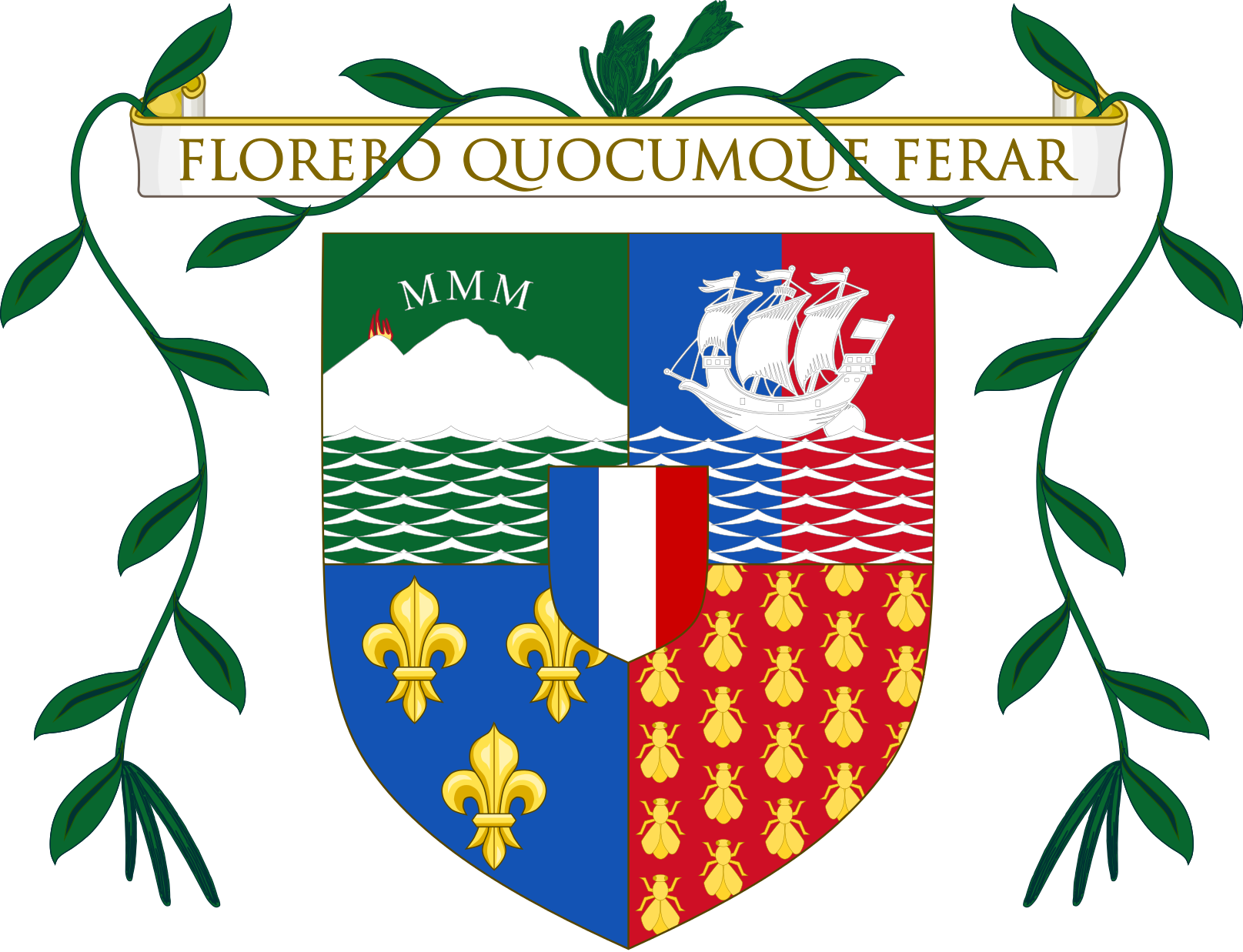
| Republic of the Southern Indian Ocean Islands République des Îles australes de l'Océan Indien
| |||||
|---|---|---|---|---|---|
| |||||
|
Motto: Solitas fatum nostrum est Solitude is our fate | |||||
|
Anthem: L'océanique | |||||
![Location of the Southern Indian Ocean Islands[1]](https://static.wikia.nocookie.net/conworld/images/3/38/Southern_Indian_Ocean_Islands_location_map.png/revision/latest?cb=20150822011949) Location of the Southern Indian Ocean Islands[1] | |||||
| Capital |
Port-aux-Français Port-Christmas (former) | ||||
| Largest City | Port-aux-Français | ||||
| Official languages |
(Indian Ocean) French English | ||||
| Ethnic groups |
45.84% French 23.76% Black African 17.55% Yiddish 9.18% Australian 3.67% Other | ||||
| Government | Federal constitutional parliamentary republic with a president as head of state | ||||
• President |
Fréderique Lafélâtabvre | ||||
• Prime Minister |
Geneviève Thérèse Lasuroux | ||||
| Establishment | |||||
• Independence from France |
1956 | ||||
• Heard Island and McDonald Islands independent from Australia |
1960 | ||||
• Prince Edward Islands independent from South Africa |
1982 | ||||
| 1985 | |||||
| Area | |||||
• Total |
55,128,530 km2 (21,285,240 sq mi) | ||||
• Water (%) |
85.6% | ||||
| Population | |||||
• Estimate |
86,988 | ||||
• Density |
0.0016/km2 (0.0/sq mi) | ||||
| GDP (PPP) | 2014 estimate | ||||
• Total |
$3.410 billion | ||||
• Per capita |
$39,200 | ||||
| GDP (nominal) | 2014 estimate estimate | ||||
• Total |
$4.105 billion | ||||
• Per capita |
$47,190 | ||||
| HDI (2014) |
0.900 very high | ||||
| Currency | Island franc (ilf) | ||||
| Time zone |
UTC+03:00 UTC+04:00 UTC+05:00 | ||||
| Calling code | +380 | ||||
| Internet TLD | .ios | ||||
This Nation is part of the Nearly Real World
The Republic of the Southern Indian Ocean Islands (French: République des Îles australes de l'Océan Indien) is a federal state comprised of seven island provinces comprising a total of 314 islands and countless smaller rocks, skerries, and rock reefs. Its total landsmass covers approximately 8329 km² and its population is just under 87,000. It is a semi-presidential republic with its capital in Port-aux-Français, the country's largest city.
The provinces of East Kerguelen and West Kerguelen (then as the Kerguelen Islands), the Crozet Archipelago, Amsterdam Island, and Saint Paul Island gained independence from the French Republic in 1956. They were joined by the Heard Island and McDonald Islands in 1960 after they gained independence from Australia, and finally by the Prince Edward Islands in 1982 after they gained independence from South Africa. The final constitution, ratified in 1985, established the islands as a federal republic consisting of seven provinces.
The Southern Indian Ocean Islands is known for being a very liberal country, having legalised abortion, euthanasia, and prostitution, whilst maintaining a very progressive drugs policy. It was the second country in the world, after the Netherlands, to legalise same-sex marriage and is known for being very LGBT friendly. The country has not outlawed the death penalty. It joined the African Union in 2009.
The inhabitants mainly speak French, although the provinces of Heard Island and McDonald Islands, and Prince Edward Islands are predominantly anglophone.
Etymology[]
At initial independence, in 1956, the newly established republic bore the name La république des Archipels de Kerguelen et de Crozet et des Îles d'Amsterdam et de Saint-Paul de l'ancien territoire des Terres australes et antarctiques françaises (the Republic of the Kerguelen and Crozet Archipelagoes and the Amsterdam and Saint Paul Islands of the former territory of the French Southern and Antarctic Lands), generally shortened to République des Archipels et des Îles (Republic of Archipelagoes and Islands), as so provided by the First Constitution of the Southern Indian Ocean Islands. This name was maintained until 1960.
With the inclusion of the Australian territory of Heard Island and McDonald Islands into the republic in 1960 and the subsequent bilinguality of the republic, the name was altered as well as officially in two languages: French and English. The new name was La république des Archipels de Kerguelen et de Crozet et des Îles d'Amsterdam et de Saint-Paul de l'ancien territoire des Terres australes et antarctiques françaises et l'Archipel de l'ancien territoire d'Australia des Îles Heard-et-McDonalds in French, and Republic of the Kerguelen and Crozet Archipelagoes and the Amsterdam and Saint Paul Islands of the former territory of the French Southern and Antarctic Lands and the Former Australian Territory of Heard Islands and McDonald Islands in English, as provided by the Second Constitution. This name was maintained until 1982.
When in 1982 the Prince Edward Islands joined the republic the name was altered again temporarily in the Third Constitution prior to the main constitutional revision of the Fourth Constitution into La république des Archipels de Kerguelen et de Crozet et des Îles d'Amsterdam et de Saint-Paul de l'ancien territoire des Terres australes et antarctiques françaises, de l'Archipel de l'ancien territoire d'Australia des Îles Heard-et-McDonalds et de l'Archipel du Prince-Édouard in French, and Republic of the Kerguelen and Crozet Archipelagoes and the Amsterdam and Saint Paul Islands of the former territory of the French Southern and Antarctic Lands, the Former Australian Territory of Heard Islands and McDonald Islands, and the Prince Edward Islands in English.
Recognising the need for a shorter name, the Fourth Constitution provided the current name in reference to the location of the constituent islands.
History[]
For history specific for each island or archipelago, see history of the Southern Indian Ocean Islands by island.
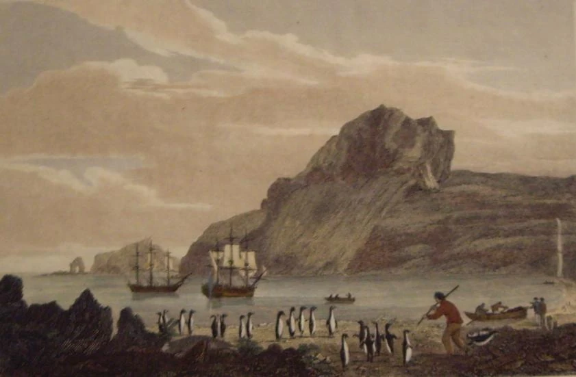
Christmas Harbour, Kerguelens Land, dated 1811 by George Cooke, shows the landing of whalers and sealers in Port-Christmas.
All islands and archipelagoes were devoid of any human settlement or population until the 16th, 17th, 18th and 19th centuries. The islands were initially settled by temporary whalers and sealers, mostly from Britain, the USA, and Norway, and fishermen who came mostly from La Réunion. Sometime during the 19th century, women and children were brought to the Kerguelen Islands from La Réunion and Continental France, whilst the Prince Edward Islands and the Heard and McDonald Islands saw settlement from South African and Australian colonists respectively.
Les terres australes[]
Until 1955, the Kerguelen Islands, the Crozet Archipelago, and the islands of Saint Paul and Amsterdam were part of the French colony of Madagascar. That same year they collectively became known as Les Terres australes et antarctiques françaises (French Southern and Antarctic Lands) and were administratively part of the French Départment d'outre-mer de la Réunion. However, calls for independence had been constant since the 1920s, and they were granted one year later on 1 December, 1956 after the Déclaration d'Indépendance des Terres australes and the ratification of the First Constitution of the Southern Indian Ocean Islands.
Heard and McDonald Islands[]
Until 1947, the Heard and McDonald Islands were an overseas territory of the United Kingdom. That year they were transferred to the Commonwealth of Australia for reasons of proximity, but against the wishes of the local population. Wishing for independence from Australia, the legislature of the Heard and McDonald Islands, the Government of Australia, and the Government of the Southern Indian Ocean Islands began diplomatic talks for a transfer of the islands in 1958, and on 1 December, 1960 the Heard and McDonald Islands were incorporated as a province after the ratification of the Second Constitution of the Southern Indian Ocean Islands.
Prince Edward Islands[]
The Prince Edward Islands were claimed for South Africa in 1947 (Marion Island) and 1948 (Prince Edward Island), and settled in the years after that, mostly with negro inhabitants from the mainland on the African continent. As the negro population outnumbered the white population 25 to 1, there was an opportunity for growing discontentment with the South African system of apartheid, and the negro community sent representatives to the Government of the Southern Indian Ocean Islands to negotiate a transfer of the islands in 1971.
The Government of South Africa was against a transfer of the islands and threatened with military measures against the Southern Indian Ocean Islands if they were to go through with annexing the Prince Edward Islands. Hostility between the two nations increased over the years as no official statement was provided either affirming or denying that the Southern Indian Ocean Islands were planning to annex the archipelago, and eventually came to a skirmish within the marine area of soveignty of the Southern Indian Ocean Islands on 17 July, 1977.
In response the president (Mme Alaine Dutroux at the time) and her ministers convened in the Palais à la Rivière on the same day and discussed the skirmish throughout the night. The next morning a special session of the Parlement féderal was called as the president and her ministers proposed before the parliament a declaration of war against South Africa, and separately a statement declaring that the Prince Edward Islands were considered a part of the Southern Indian Ocean Islands, which she hoped the parliament would support.
On 24 July, 1977 the parliament convened and debated the matter before them. After a debate lasting two days, the Federal Assembly voted 93-2 in favour of the declaration of war, with 5 abstaining, and the Senate voted 16-0 in favour of the declaration of war, with two abstaining. As such, the War of the Indian Ocean had begun.
Immediately after the declaration a fleet of ships and aircraft headed for the Prince Edward Islands. On 17 August, 1977 the fleet arrived before the archipelago and was met by the South African Navy. After two hours of manoeuvring, the Southern Indian Ocean Islands' Navy shot the first missile towards the South African Army, and thereby began the Battle of Marion Island, which lasted ten weeks.
On 24 October of the same year, after over two and a half months of battle and much damage and several casualties on both sides, the Southern Indian Ocean Islands' forces took over Marion Island. They then continued for Prince Edward Island in the Battle of Prince Edward and took over that island within a week. Having been defeated at the Prince Edward Islands, the South African Navy left the area, but steamed for Amsterdam and Saint Paul Islands, where defence had been significantly lowered for the battle at the Prince Edward Islands. The Southern Indian Ocean Islands requested support from the French military forces station in La Réunion, and together with the French the Southern Indian Ocean Islands' air forces attacked the South African naval fleet in the Battle in the Middle of Nowhere (Bataille au milieu de nulle part in French).
Skirmishes and hostile encounters continued between the French, the Southern Indian Ocean Islands, and South Africa between 1977 and 1982, until South Africa finally admitted defeat and granted Marion Island to the Southern Indian Ocean Islands. The Cease-fire of Little Port was signed on 12 April, 1982, and the Third Constitution of the Southern Indian Ocean Islands was ratified to include Marion Island. Prince Edward Island remained in jure part of South Africa but was under de facto control of the Southern Indian Ocean Islands. On 1 December, 1985 Prince Edward Island was finally transferred to the Southern Indian Ocean Islands and incorporated under the Fourth Constitution of the Southern Indian Ocean Islands.
20th century from 1985[]
The islands of the Republic continued in very different manners due to their remoteness not only from the rest of the world, but also from each other. Despite their remoteness, however, the federal government made sure to constantly modernise. The Kerguelen Airport was modernised, the military was modernised, the ferries between the different archipelagoes were replaced with more durable ones, and in 1995 the Republic's first, and so far only rail network was opened on the Kerguelen. The World Wide Web was made available in each province in 1999 by the federal government.
21st century[]
The Southern Indian Ocean Islands were the second nation to legalise same-sex marriage on 1 December, 2001, eight months after it was legalised in the Netherlands.
The nation continued and still continues to be modernised, as proven by the fact that in 2005 the country's energy supply consisted entirely of sustainable energy.
Possible future territorial expansions[]
For more information, see candidates for incorporation into the Republic of the Southern Indian Ocean Islands and Sovereign Antarctica.
In 2014 there were calls from Christmas Island and Bouvet Island to be incorporated into the Republic. Exploratory diplomatic talks have been on-going[2][3]
In 2015, the Government of Australia proposed the creation of a confederation, known in the current phase as the Confederation of the Indian Ocean. An exploratory diplomatic mission has been set up and talks are still on-going.
It has been suggested by several members of the international community to transfer the entirety of Antarctica to the Southern Indian Ocean Islands. The Republic plans to assume soveignty over any unclaimed Antarctic area December 1, 2016, and is having diplomatic discussions about the transfer of other claims with various nations, notably Norway and Australia.
On March 20, 2016, the Treaty of Heard Island was signed. Following the signing of this treaty, three parts of Antarctica, namely Adélie Land from France, the Australian Antarctic Territory, and the unclaimed Marie Byrd Land, were officially transferred to the Southern Indian Ocean Islands, to be administrated as a Federal Generality Territory. This was concluded on 1 April, 2016.
Geography[]
The Southern Indian Ocean Islands consists of four archipelagoes and two islands, all of which are volcanic in origin and all islands consist of potentially active volcanoes. Each island and archipelago exists as its own federal constituent province, except the Kerguelen archipelago, which is divided into an eastern and western province. The capital city is Port-aux-Français, also known as Port-de-Kerguelen.
Subdivisions[]
For more information, see: subdivisions of the Southern Indian Ocean Islands.
The Southern Indian Ocean Islands are divided into seven provinces, shown in this table:
| Province | French name | Capital City | Population | Area |
|---|---|---|---|---|
| East Kerguelen | Archipel Kerguelen d'Est | Port-aux-Français | 41,200 | 29,337 km2 |
| West Kerguelen | Archipel Kerguelen d'Ouest | Port-Christmas | 9,010 | 90,893 km2 |
| Crozet Archipelago | Archipel Crozet | La-Possession-d'Île | 5,355 | 47,389 km2 |
| Heard Island and McDonald Islands | Îles Heard-et-McDonald | Queen Elizabeth Harbour | 7,981 | 64,262 km2 |
| Amsterdam Island | Île Amsterdam | La Roche Godon | 2,080 | 617 km2 |
| Saint Paul Island | Île Saint-Paul | Port-de-Saint-Paul | 692 | 114 km2 |
| Prince Edward Islands | Archipel du Prince-Édouard | Marion Harbour | 20,670 | 68,116 km2 |
| FGT Antarctica | TGF de l'Antarctique | n/a | 0 | 7,938,500 km² |
Each of these provinces has its own parliamentary legislature and enjoys a high degree of autonomy within the republic.
The second level of subdivisions consists of the communes. These are localities with a communal council, responsible for the issuance of identification papers, passports, and for the taxation for local maintenance. There are a total of 27 communes.
Geology[]
Kerguelen Plateau[]
Kerguelen Archipelago[]
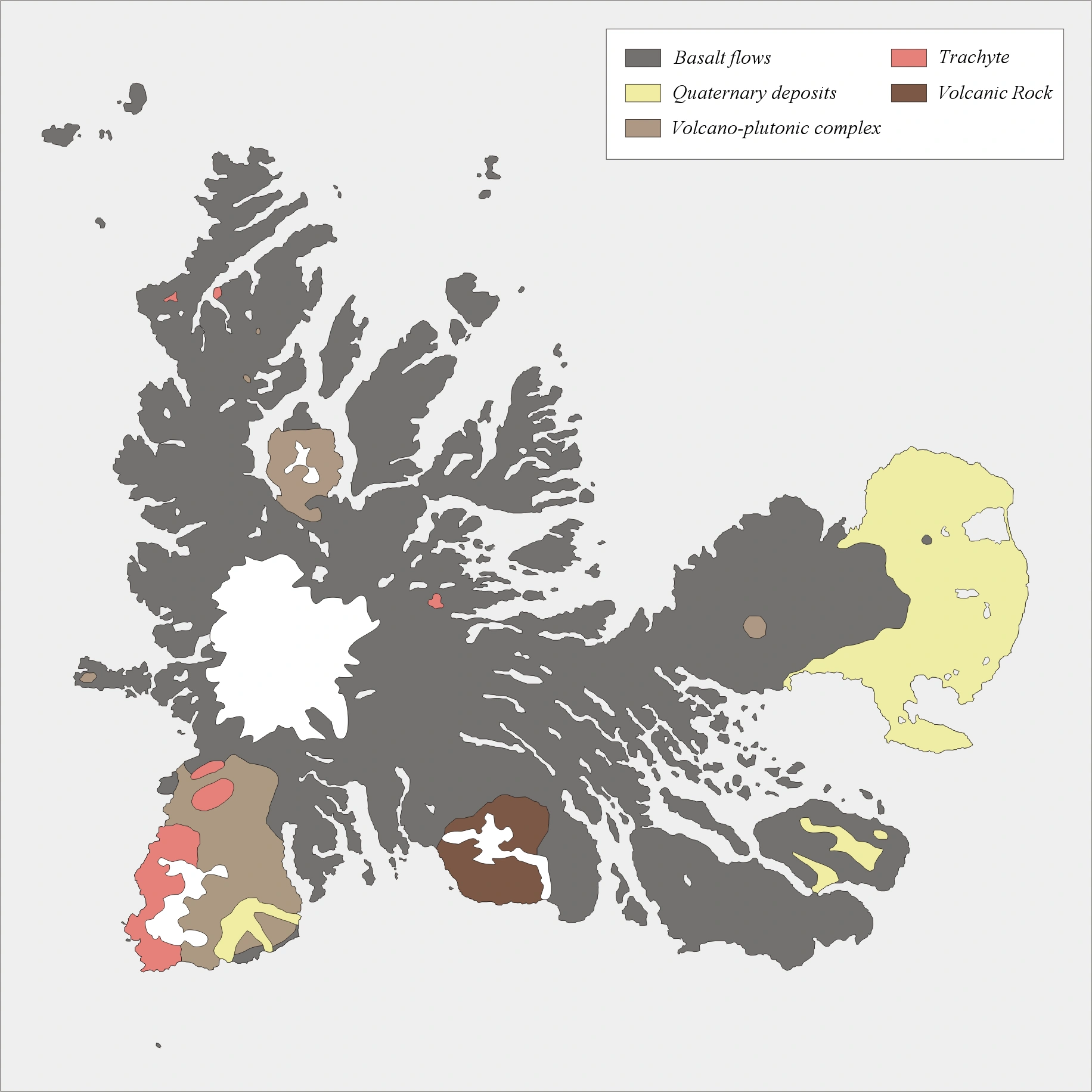
A simplified map of the geography of the Kerguelen archipel.
The Southern Indian Ocean Islands consists of several distinct geographical entities, the largest of which is the Kerguelen Plateau, a microcontinent, which extends over 2,200 kilometres in a northwest-southeast direction in deep waters. The Kerguelen hotspot has produced the Kerguelen Islands, Heard Island, and the McDonald Islands through volcanic eruptions of basaltic lava, which still continue to this day. Especially the McDonald Islands are still very active at present.
The major part of the volcanic formations visible on the islands is characteristic of an effusive volcanism, which caused a trap rock formation to start emerging above the level of the ocean 35 million years ago. The accumulation is of a considerable amount; basalt flows, each with a thickness of three to ten metres, stacked on top of each other, sometimes up to a depth of 1,200 metres. This form of volcanism creates a monumental relief shaped as stairs of pyramids.
Other forms of volcanism are present locally, such as the strombolian volcano Mont Ross, and the volcano-plutonic complex on the Rallier du Baty peninsula. Various veins and extrusions of lava such as trachytes, trachyphonolites and phonolites are common all over the islands. There has not been any eruptive activity in recent history, but some fumaroles are still active in the southwest of Grande-Terre, in the commune of Péninsule Rallier du Baty.
The largest islands of the Kerguelen Archipelago is the aforementioned Grande-Terre. The entire archipelago consists of approximately 300 named islands and various smallers rocklets and skerries. It has some glacial forming.
There is a small group of islets and rocks about 10 kilometres north of Heard Island, consisting of Shag Islet, Sail Rock, Morgan Island and Black Rock. Of these, Shag Island is inhabited, with a population of 27.
Heard Island[]
Heard Island is a volcanic island covered in both glaciers and lava streams. The island is covered by 41 glaciers and is 80% covered with ice. It is dominated by Mawson Peak, a complex volcano which is part of the Big Ben Massif of the islands. From the southwest slope the Heard Lava Flow flows from the summit of Big Ben.
The land not covered in ice is barely arable and is mostly used for cattle. The land near the coast is arable however, and is home to the island's few farms.
McDonald Islands[]
The McDonald Islands are located 44 kilometres to the west from Heard Island and are completely uninhabited. It consists of three tiny volcanic islands; McDonald Island, Flat Island, and Meyer Rock. The volcano on McDonald Island, after having been dormant for 75,000 years, erupted in 1992, with its last eruption in 2004.
Prince Edward Islands[]
The peaks of an underwater shield volcano, the Prince Edward Islands are both volcanic in origin. The larger island is Marion Island, and the smaller island is Prince Edward Island.
The volcano on Marion Island erupted in 1980 for the first time in 75,000 years, simultaneously with the eruption on McDonald Island. Its last eruption, like McDonald Island, was in 2004.
Crozet Islands[]
The Crozet Islands are six small islands located between the Kerguelen and the Prince Edward Islands. They are divided into the L'Occidental and the L'Oriental islands. The islands of Pig Island, Possession Island, and East Island are inhabited.
Analysis of magnetic anomalies on the sea floor indicates that the Crozet Plateau formed some 50 million years ago. The islands are of volcanic origin, and basalt. Rock samples indicate volcanic origins going back to at least 8.8 million years.
Amsterdam Island[]
Amsterdam Island is located in the middle of the Indian Ocean, 85 kilometres north of Saint Paul Island.
The volcanic island is a potentially active volcano which last erupted in 1792. It is dominated by the Mont de la Dives. The high central area of the island, containing its peaks and caldera, is known as the Plateau des Tourbières (English: Plateau of Bogs). The cliffs that characterise the western coastline of the island are known as the Falaises d'Entrecasteaux after 18th-century French navigator Bruni d'Entrecasteaux.
Saint Paul Island[]
Saint Paul Island is located in the middle of the Indian Ocean, 85 kilometres south of Amsterdam Islan.
The island is triangular in shape, and measures no more than 4.8 km at its widest. It is the top of an active volcano, the volcano last erupted in 1793, and is rocky with steep cliffs on the east side. The thin stretch of rock that used to close off the crater collapsed in 1780, admitting the sea through a 100 m channel; the entrance is only a few meters deep, thus allowing only very small ships or boats to enter the crater. The interior basin, 1 km wide and 50 m deep, is surrounded by steep walls up to 270 m high. There are active thermal springs.
Politics[]
For more information, see politics of the Southern Indian Ocean Islands. The Republic of the Southern Indian Ocean Islands is a federal and constitutional parliamentary republic.
The republic is divided into seven distinct autonomous regions, known as provinces, with power relegated to them from the federal government through the constitution. A change of the constitution must first be approved by a two-thirds majority in each provincial legislature.
The Constitution[]
The Constitution of the Southern Indian Ocean Islands, currently on its fourth version, is the constitution which regulates the political system of the republic. The constitution consists of several distinct parts focusing on the following subjects:
- Basic Rights, focusing on the basic human rights of all inhabitants and visitors to the republic, focusing on both the overlaps and distinctions between the two different groups.
- Government, focusing on the president and his or her ministers.
- Provinces-General, focusing on the federal government of the republic.
- Legislatures-Provincial, focusing on the provincial legislatures.
- Councils-Communal and Other Elected Organisations, focusing on the communes, Fishing Boards, Coastguard, Police Commissioners and EERCs.
- Administration of Justice.
Federal politics[]
At the federal level, the Southern Indian Ocean Islands are a constitutional parliamentary republic with a president as head of state.
Legislature[]
The Southern Indian Ocean Islands have a bicameral federal legislature, with a Federal Assembly and a Senate, who convene in Palais de l'Indépendance in Port-aux-Français.
Members of the Federal Assembly are directly elected by the population on a per-province basis. There are a total of 100 electable seats, and the number of seats a province gets allotted depends on the province's population. As such, East Kerguelen gets 48 seats, Prince Edward Islands gets 24 seats, West Kerguelen gets 10 seats, Heard and McDonald Islands gets 9 seats, Crozet Archipelago gets 6 seats, Amsterdam Island gets 2 seats, and Saint Paul Island gets 1 seat.
The Senate comprises a total of 21 electable seats; three per province. Two Senators per province is elected by the province's population, and the remaining one is elected by the province's legislature. The Senators elected by Legislatures-Provincial are required to present federal legislative proposals before the Legislature-Provincial for a vote, and carry the provincial vote into the Senate vote.
Both the Federal Assembly and the Senate hold the right to information, the right for amendment, the right of interpellation, the right of enquiry, and the right of budget. Both chambers have the right to draft legislation, but any legislative proposal or amendment must first be approved by both chambers.
Provincial politics[]
Each province has a unicameral legislature, Governor, and Supreme Court.
Communal politics[]
There are 27 communes in the Republic of the Southern Indian Ocean Islands. Communal governments control waste disposal and other local services. Communal governments consist of a Communal Council, whose Chairperson is the communal executive, and a Communal Court.
Elections[]
Political parties[]
There are six parties with representation in the federal legislature, and three other parties.
| Colour | Logo | Name | Founded | Ideology | Seats in Senate | Seats in Federal Assembly | Coalition | Governorships |
|---|---|---|---|---|---|---|---|---|
| Yellow | Liberal Party | 1956 | Liberalism, Pro-Africanism | 6/21 | 45/100 | Liberal-Conservative | 1/7 | |
| Blue | Conservative Party | 1956 | Liberal conservatism,
Christian democracy, Pro-Africanism |
7/21 | 16/100 | Liberal-Conservative | 3/7 | |
| Red | Labour Party | 1960 | Social democracy,
democratic socialism, Pro-Africanism |
4/21 | 15/100 | Labour-Green | 2/7 | |
| Green | Green Party | 1990 | Green politics, social
democracy, social liberalism, eco-socialism, Pro-Africanism |
3/21 | 14/100 | Labour-Green | 1/7 | |
| Pink | Socialist Party | 1956 | Democratic socialism,
Afrosceptiscism |
1/21 | 9/100 | None | 0/7 | |
| Black | National Front | 1964 | National conservatism,
social conservatism, Afrosceptism |
0/21 | 1/100 | None | 0/7 |
| Colour | Logo | Name | Founded | Ideology | Seats in provincial legislatures | Seats in Communal Councils |
|---|---|---|---|---|---|---|
| Red | Antarctic Communist
Party |
1934 | Communism,
Marxism |
2/200 | 13/321 | |
| Turquoise | Marion National Party | 2004 | Prince Edward
and Crozet Islands independence, centrism |
4/200 | 23/321 | |
| Green | Centre Party | 1956 | Agrarianism, liberalism | 1/200 | 4/321 |
Judiciary[]
The judiciary of the Republic of the Southern Indian Ocean Islands consists of the Supreme Court and five Federal Courts.
Military[]
For more information, see military of the Southern Indian Ocean Islands.
The Southern Indian Ocean Islands do not have an army, but compensate for that with their well-equipped navy and airforce, the Marine de la République and the Forces aériennes de la République.
The Republic's naval fleet consists of 5 Independence-class littoral combat ships, 7 Flamant-class patrol vessels, 6 Durango-class patrol vessels, 3 Lerici-class minehunters, 3 Collins-class submarines 1 Foudre-class landing platform dock and 1 fleet carrier. With 12,300 active duty personnel, 14% of the population of the Republic works for the Navy.
The Republic's air fleet consists of 15 F-22 aircraft, 10 F16 aircraft, 7 Auroras, 6 Boeing AH-64 Apaches, 4 C-5 aircraft, 2 Nighthawks and 2 U-2 aircraft. With 4,700 active duty personnel, 5.5% of the population of the Republic works for the airforce.
Economy[]
For more information, see economy of the Southern Indian Ocean Island.
Economic basis[]
The Southern Indian Ocean Islands' economy is focused mainly around fishing, the export of oil, geological research, and tourism. It has a very open economy and depends on import for most agricultural necessities, whilst exporting fish and oil. Its main export partners are Australia (20.2%), South Africa (19.7%), France (19.2%) and the Netherlands (13.3%). Its main import partners are Australia (35.9%), South Africa (19.4%), India (18.5%), France (15.0%) and the Netherlands (14.3%).
The Southern Indian Ocean Islands possess large oil fields surrounding mostly the Kerguelen Islands. With approximately 828,000 bbl/day the Southern Indian Ocean Islands hold a 1.6% share of the worldwide oil production and share the 28th place of oil-producing countries with Indonesia.
The Southern Indian Ocean Islands also possess vast fishing fields in its own Exclusive Economic Zone, which yield around 216,302 tonnes of fish per year. An additional 276,989 tonnes of fish per year are produced through aquaculture. Furthermore, the Southern Indian Ocean Islands also cultivate seaweed, glasswort and sea aster for consumption and export to mainly Australia and the Netherlands.
The Southern Indian Ocean Islands use the Island franc or Franc d'îles, which used to be tied to the French franc until 2002, when the French franc was replaced by the Euro. After this, the Island franc was tied to the Australian dollar.
Energy[]
The energy supply of the Southern Indian Ocean Islands is completely sustainable and is obtained individually per island or archipelago. This is most often achieved by using wind turbines, but also through the obtainment of geothermal electricity on the Kerguelen Islands and the Heard and McDonald Islands.
Tourism[]
Tourism is a very important industry in the Southern Indian Ocean Islands, as it welcomes around 4 million tourists every year. Most tourists arrive either by plane (67%) or by cruise (20); the remaining 13% arrive either by private vessel, ferry, or cargo ship.
The most popular tourist destinations are Port-aux-Français, Les-Roches-du-Nord, the Vallée des Sables, the Presqu'îles jumelles, Saint-Paul Island, Marion Island, and Heard Island.
Research by the Department of the Economy has concluded that tourists visit the nation mostly for its natural beauty (89%), sea (83%), and remoteness (75%).
Transport[]
The quality and quantity of infrastructure differs greatly depending on the province. This ranges from a complete 690 km long railway network and a double-runway airport on the Kerguelen Islands to virtually no infrastructure outside of the village on Saint-Paul Island.
The most important connections between the islands are the Grand Trois des Mers, the three ferry services connecting the islands with each other. These are the Traversier des trois archipels, connecting the Prince Edward Islands and the Crozet Archipelago with the Kerguelen Islands; the Heard Shuttle, connecting Heard and McDonald Islands with the Kerguelen Islands; and the Connexion du Nord-Sud, connecting Amsterdam Island and Saint-Paul Island with the Kerguelen Islands. A weekly ferry service also shuttles between Durban and the Prince Edward Islands.
The Kerguelen Airport is the only airport of the entire Southern Indian Ocean Islands and provides direct connections with Cape Town International Airport in South Africa, Adelaide and Sydney in Australia, Paris-Charles de Gaulle via Roland Garros Airport on Réunion in France, Antananarivo in Madagascar, and Buenos Aires in Argentina.
The islands of Grande Terre and Marion Island have highways connecting the various villages and towns, whilst the other islands generally have few to virtually no roads outside of their main villages. As most islands only contain one village, save for Amsterdam Island, there is no real necessity for highways on these islands.
The Kerguelen rail network is the only rail network of the Southern Indian Ocean Islands and covers 690 kilometres and serves 33 stations. All rail lines are nonelectrified and currently served by Stadler GTWs.
Demographics[]
For more information, see demographics of the Southern Indian Ocean Islands.
The Southern Indian Ocean Islands had an estimated population of 86,988 on 10 December, 2014. Of these, 47,234 (54.3%) were female and 39,754 (45.7%) were male. The population growth has been more or less steady since the 1970s, with an a population increase of 123, or 0.14%, between 1972 and 2014.
The fertility rates in the Southern Indian Ocean Islands is at 1.43 children per woman (2014 est.), which is below the 2.1 children per woman required for natural population replacement. Life expectancy on the other hand is high: 85.66 for newborn girls, and 82.98 for newborn boys. Due to the remoteness of the islands and the strict immigration policies, the immigration rate stands at 0.01 immigrants per 1,000 inhabitants per year; emigration rates are relatively higher, although still not extreme, at 1 emigrant per 1,000 inhabitants per year.
The majority of the population of the Southern Indian Ocean Islands is ethnically French, although they hold Southern Indian Ocean Islands citizenship rather French citizenship. During the 2014 census, 45.84% stated they were ethnically French, 23.76% black African, 17.55% Ashkenazi Jewish[4], 9.18% Australian, and 3.67% other. Most of those who are ethnically French reside on the Kerguelen Islands, Crozet Islands, Saint-Paul Island or Amsterdam Island; most black Africans reside on the Prince Edward Islands; most ethnically Australians reside on the Heard and McDonald Islands; and most Ashkenazi Jews live in areas in Port-aux-Français. There is however significant interaction and migration between the islands, as well as several ethnic enclaves like Port-Australie on the Kerguelen (Australian enclave) or La Grange on Marion Island (French enclave).
The people of the Southern Indian Ocean Islands are amongst the tallest in the world, with an average height of 1.79 cm for adult males and 1.72 cm for adult females in 2010. The people on the Kerguelen Islands are on average 3 cm taller than the national average.
When calculating the population density, the average will be 0.0018 inhabitants per km², which makes it the 201st most densely populated sovereign nation in the world; in other words, it is the least densely populated country in the world, far behind Mongolia, which is the second least populated with 1.92 inhabitants per km². Even when dependent territories are counted, the Southern Indian Ocean Islands still come behind Greenland, which has a population density of 0.3 inhabitants per km². However, when the population density is calculated by total available landmass rather than total sovereign area, a population density of 10.44 inhabitants per km² is achieved.
| Rank | Province | Pop. | Rank | Province | Pop. | ||||
|---|---|---|---|---|---|---|---|---|---|
| 1 | Port-aux-Français | East Kerguelen | 6,690 | 11 | Ilford Road | Prince Edward Islands | 2,391 | ||
| 2 | Heard Village | Heard and McDonald Islands | 6,621 | 12 | Port-Christmas | West Kerguelen | 2,032 | ||
| 3 | Molloy | East Kerguelen | 5,778 | 13 | La Grange | Prince Edward Islands | 2,002 | ||
| 4 | Lower Marion | Prince Edward Islands | 5,012 | 14 | Aux-Lacs-d'Hermance-et-d'Entr'Aigues | East Kerguelen | 1,952 | ||
| 5 | Prince Edward | Prince Edward Islands | 4,921 | 15 | Port-Douzième | East Kerguelen | 1,792 | ||
| 6 | Port-Couvreux | East Kerguelen | 3,442 | 16 | Port-Jeanne d'Arc | East Kerguelen | 1,762 | ||
| 7 | Port-de-la-Baie-Norvégienne | East Kerguelen | 3,425 | 17 | Port-du-Cap-Digby | East Kerguelen | 1,672 | ||
| 8 | Port-du-Prince-des-Galles | East Kerguelen | 3,265 | 18 | Port-Ronarc'h | East Kerguelen | 1,658 | ||
| 9 | La Possession | Crozet Islands | 2,687 | 19 | De Ratmanoff | East Kerguelen | 1,530 | ||
| 10 | Looe | Prince Edward Islands | 2,464 | 20 | L'Occidental | Crozet Islands | 1,354 | ||
Culture[]
Art, philosophy and literature[]
Value system and etiquette[]
Music[]
Media[]
The Southern Indian Ocean Islands have an active and independent media as the country takes in the third place on the World Press Freedom Index. There are two main television news organisations as well as French national and international news broadcasts on TF1, France 2 and TV5Monde, four news radio broadcasts, and a wide variety of newspapers, tabloids, and magazines.
The two main news organisations are RTA1 with their flagship news broadcast Le 1930 and MT3 with their flagship news broadcast 21 Heures. In addition to these flagship broadcasts, RTA1 provides hourly news updates through their news programme Cette Heure, whilst MT3 provides non-stop economic news in their programme L'économie. Both organisations also provide an English news broadcast for the anglophones every two or three hours depending on the day.
There are three main newspapers, namely La Vague, Le Pêcheur and the anglophone The Republic's Times.
Films and television[]
Sports[]
Cuisine[]
Notes[]
- ↑ Red indicates approximate provincial areas; the blue line marks the border of the Republic's established marine sovereignty.
- ↑ In case Christmas Island is indeed accepted as a new area of the Republic, the usage of Terres australes would become incorrect. Proposals for a name change include Terres australes et orientales de l'Océan Indien and La république des îles.
- ↑ In case Bouvet Island is indeed accepted as a new area of the Republic, the usage of de l'Océan Indien would become incorrect. Proposals for a name change include Terres australes des Océans and Terres australes des Océans Indien et Atlantique.
- ↑ "Yiddish" in the official census terminology.